Maps
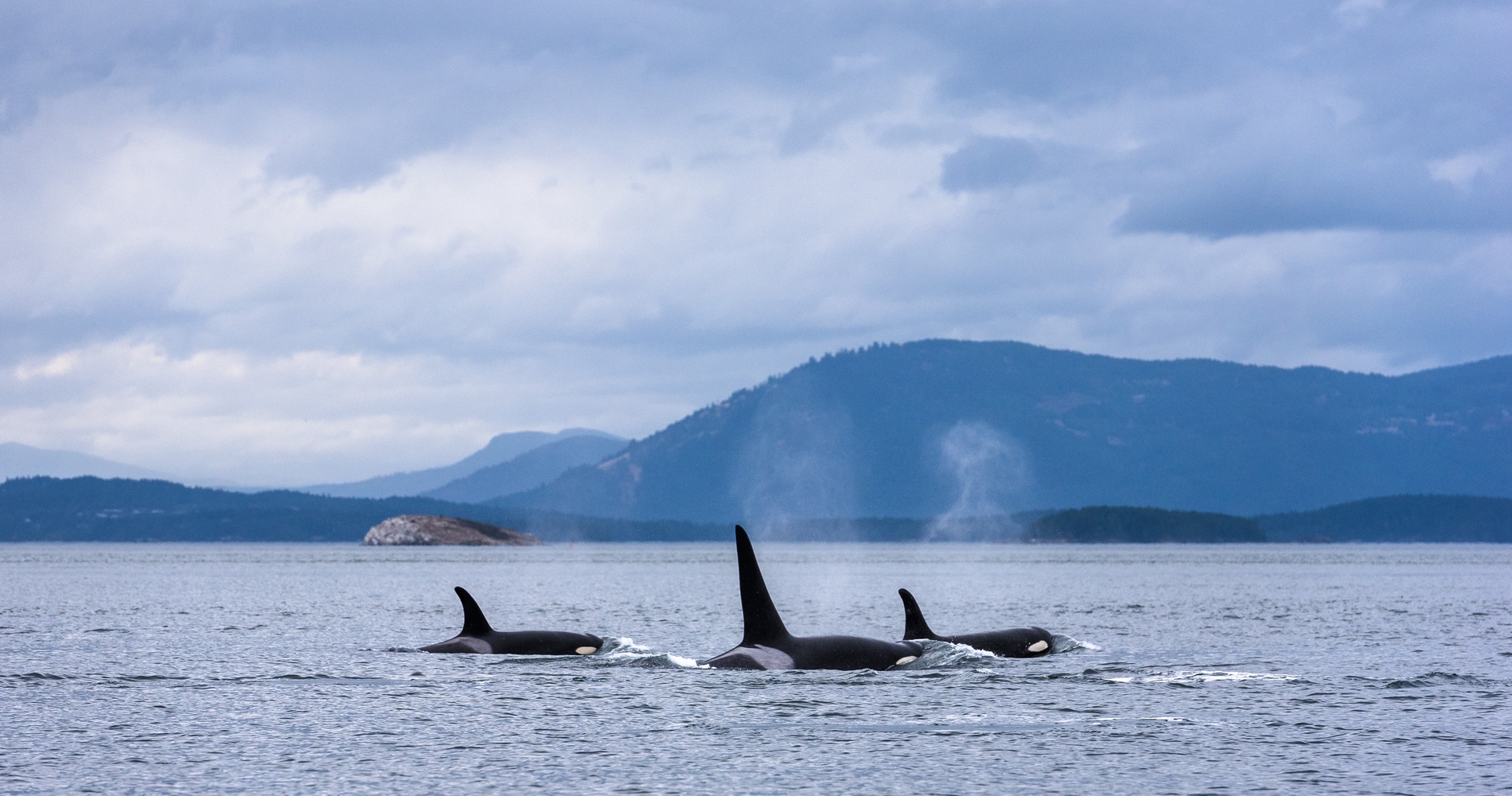
Three Orcas with a Mountain backdrop Credit Destination BC/Reuben Krabbe

Vancouver Island Road Trip: Victoria to Port Hardy

5 to 7 Days, 500 km (310.69 mi)

Relax and rejuvenate along this coastal road trip from Victoria to northern Vancouver Island, and explore nature and wildlife along the way.

Share  Facebook Twitter pinterest logoPinterest

From the provincial capital of Victoria, travel up the eastern shore of Vancouver Island through laid-back coastal communities and lush rainforest scenery that help you embrace “island time.” The longer you stay, the more noticeable the transformation. Follow the route below, which includes optional detours and travel ideas, to reset and recharge.

Part 1

Tsawwassen

Salt Spring Island | Reuben Krabbe

Sail from Tsawwassen, south of Vancouver, with BC Ferries and take in the beautiful ocean vistas as you weave among the Southern Gulf Islands en route to Swartz Bay, at the south end of Vancouver Island. Consider a detour to Salt Spring, Galiano, Mayne, Saturna and/or Pender islands, each with its own character and natural splendour.


Part 2

Victoria

Fairmont Empress Hotel in Victoria | Reuben Krabbe

If you want to start your journey with a little urban enjoyment, take time out to visit BC’s capital city, Victoria. No trip to Victoria is complete without a walk by the seashore, whether that’s in the bustling Inner Harbour or on the quiet stretch of Dallas Road across from pretty Beacon Hill Park. You can also peruse BC’s 9,000-year-old human history at the Royal BC Museum.

If city life is not for you, head straight toward the 25-minute ferry crossing from Brentwood Bay to Mill Bay for more memorable views from the water. Time permitting, tour renowned Butchart Gardens before you board the ferry, or drive to Kinsol Trestle, one of the world’s largest free-standing railway trestle bridges, along the Cowichan Valley Trail. Ride your bike across, or walk across the bridge and marvel at its beauty and structure.

From there, continue north along Highway 1 toward Duncan. As you head over the summit of Malahat Drive, pull into the viewpoint for panoramic views over Saanich Inlet and the Saanich Peninsula to distant Mount Baker.

Part 3

Duncan

Duncan | Tourism Cowichan

Duncan is known as the “City of Totems,” and a highlight to your time here is a self-guided Totem Tour Walk past dozens of poles, each of which tells a story. The local Indigenous population has called the area home for thousands of years, and their relationship with the natural environment is one of respect and gratitude. This relationship is represented in many of the lovingly carved totems you’ll see along the route.

You may also want to stop by The Raptors to get up close with bald eagles, hawks, and owls before leaving town.

Once back on Highway 1 heading north, pull into the Somenos Marsh Conservation Area, one of the best spots for birding near an urban area in BC. Make friends with more than 200 different bird species and take in a “bird’s eye view” from the newly constructed viewing tower that overlooks Somenos Lake.

Art lovers should stop in the quaint, artistic city of Chemainus, best known for its collection of murals depicting the community’s history, from its Indigenous population to early European pioneers.

Continue north on Highway 1 toward Nanaimo.

Part 4

Nanaimo

The walk to Ammonite Falls | @mr_wilson3

Also accessible via BC Ferries from the mainland, Nanaimo is a jumping-off point for adventure both on land and on the water. Take a car ferry to Gabriola Island to check out the unique Malaspina Galleries, an area on the shoreline where the sandstone cliff has been eroded over time by the ocean to resemble a cresting wave. Newcastle Island is a quick 10-minute passenger ferry ride from the Nanaimo harbour, and it is a popular year-round camping destination.

Before you leave the city, you must try a local delicacy—the Nanaimo Bar. A graham/coconut/cocoa crust is topped with a creamy custard and finished off with a layer of chocolate. Yum!

Leave Nanaimo on Highway 19, and you will have a couple of choices. May we suggest the scenic route, Highway 19A.

Part 5

Parksville

Cathedral Grove | @vancitywild

Highway 19A takes you along the coast to Parksville, a pretty spot with fantastic beaches that are very busy in the summer but equally delightful in the spring and fall.  Make a day of it and enjoy the fresh sea air and the sounds of the ocean as the tide comes in. Take a short detour along Highway 4 to a series of natural treasures. Marvel at ancient and enormous Douglas fir and western red cedar trees at Cathedral Grove, or see a plunging waterfall at Little Qualicum Falls Provincial Park—both within a thirty-minute drive west of Parksville.

Continue north along Highway 19A toward the Comox Valley.

Part 6

Comox Valley

Strathcona Provincial Park | Iain Robert Reid

When you reach the Comox Valley and the communities of Courtenay, Comox, and Cumberland, you will find excellent mountain biking, a vibrant food and drink scene, and four-season fun at Mount Washington Alpine Resort. This is also the access point for rugged Strathcona Provincial Park, the oldest provincial park in BC.

Continue north along Highway 19A to its terminus in Campbell River.

Part 7

Campbell River

Elk Falls Provincial Park | Jordan Dyck

Life in Campbell River is all about the water. The community is known as the “Salmon Fishing Capital of the World” for good reason. Experienced guides can take you out in search of the area’s five species of Pacific salmon, or you can head out by boat in search of wildlife. Migrating grey whales and resident orcas are commonly seen in these waters, and Campbell River is close to prime grizzly viewing areas. The Elk Falls Suspension Bridge is another must-do. Look out over the thundering waterfall, and check out the nearby Quinsam River Hatchery.

Campbell River may mark the end of Highway 19A, but you still have a long way to go to reach the northern end of Vancouver Island. From Campbell River, there are some amazing natural experiences to be had as you drive along Highway 19 toward Telegraph Cove and Port Hardy.

Part 8

Telegraph Cove and Port Hardy

Alert Bay | Nathan Martin

The picturesque community of Telegraph Cove has a tiny year-round population that increases exponentially in the summer—a good reason to come in spring or fall. The village itself consists of colourful buildings and a boardwalk built over the water on stilts. It is a very popular destination for whale watching as its location on the shores of Johnstone Strait means almost as many whales as people.

A short ferry ride to Alert Bay on Cormorant Island takes you to U’Mista Cultural Centre and its renowned Potlatch Collection, a culturally rich collection of masks and other ceremonial objects that were restored to the Kwakwaka’wakw people after having been confiscated by the Canadian government and sent to museums around the world.

Highway 19 continues all the way to Port Hardy, Vancouver Island’s northernmost community. Spend quality time enjoying the remoteness and the solitude at peaceful Cape Scott Provincial Park at the northern tip of the Island, and then decide whether to head south again and revisit some of your favourite spots, or take a ferry to BC’s central coast and keep exploring.

Driving Directions

Part 1 - Vancouver
  • 6.25 km
  • 12 min
Show Map & Driving Directions

Travel Idea: Wildlife Viewing from the Island

Consider booking an excursion for wildlife viewing experiences at one of the island’s access points to the Great Bear Rainforest through travel operators based in and near Campbell River, Port McNeill, Port Hardy, and other communities. This route is also a great option for travellers who book longer stays in wilderness lodges within the Great Bear Rainforest and who wish to explore the Island itself before boarding any scheduled floatplanes.


Feature image: Vancouver Island | Reuben Krabbe

Last updated: Oct 23, 2023

In the Area

Plan Your Adventure Now

Need to Know

Find key travel information to plan your BC vacation.

Travel Info
Adventure Smart

Always check trail conditions before you head out, and no matter what outdoor activity you are planning, be prepared.

Plan Your Route
Plan Your Route

Check Drive BC for the latest information on road closures around the province.

Check Conditions
Travel Responsibly

Follow these tips to travel safely and responsibly in BC this season.

See the Tips
Places to Stay

Discover everything from luxury hotels and B&Bs to wilderness lodges and campsites.

Find Accommodation
#explorebc

See what's happening now with these recent posts.