Maps

Cool Towns in The Great Wilderness

Share  Facebook Twitter pinterest logoPinterest


The Great Wilderness is a place of immense scale and profound beauty. Spanning at least half the province, this far-reaching region encompasses vast mountain ranges, thousands of wilderness lakes and parks, and some of the most striking landscapes in BC. Its sheer size defies comparison—yet, for millennia, First Nations People here have carved out lives in its farthest corners.

While the region’s cities—Prince Rupert, Prince George, Dawson Creek, Fort St. John, and Terrace—serve as gateways to this expansive land, it’s the small towns nestled within that truly embody the spirit of The Great Wilderness.

Hiking Windfall Lake in Tumbler Ridge | Jesaja Class

Travel Back to the Last Ice Age and Beyond in Tumbler Ridge

Some places count their age in centuries. Then, there’s Tumbler Ridge which tells a story more than 500 million years in the making. This small community of 2,300 sits tucked into the foothills of the Rocky Mountains where plunging river-cut valleys reveal dinosaur trackways, charting a geological time frame as far back as the Triassic period. It was the discovery of these footprints by citizen scientists—along with the area’s other significant paleontological finds—that contributed to Tumbler Ridge’s designation as a UNESCO Global Geopark.

Start your trip with a visit to the museum to see fossils found nowhere else on Earth and to learn about the human history of the area, including the cultures of the Dunne-za, Saulteau, Tse’khene, Cree, and Metis peoples. Guided tours from the museum lead you into the Flatbed Valley Geosites where you can walk among dinosaur tracks that date back to prehistoric times.

Further afield, hikers and climbers can tackle dozens of trails that traverse geological formations formed by the last ice age (keep an eye out for fossils), taking you in view of fascinating rock pillars, sweeping ridges, and thundering waterfalls, including Kinuseo Falls whose 70 meters (230 feet) drop is taller than that of Niagara Falls.

Learn More
Gingolx | Grant Harder

Experience First Nations Culture and Seaside Views in Gingolx

Gingolx is one of four Nisg̱a’a Nation villages on Nisg̱a’a Lands, also referred to as the Nass River Valley. This area unfolds across a volcanic landscape filled with turquoise pools, gnarled trees, and the snaking Nass River. The molten rubble that borders the two-lane Nisg̱a’a Highway is evidence of the last volcanic eruption in Canada—and a powerful reminder of nature’s raw and unforgiving force.

Gingolx, which sits at the mouth of Kʼalii Xkʼalaan (the Portland Canal), was untouched by this cataclysmic event, and as recently as 20 years ago, access to the village remained by boat only. Today, the “Seafood Capital of the Nass” invites you to explore its seaside beauty where abundant waters teem with salmon and shellfish. Time your visit with the oolichan run—a keystone species that is foundational to the food chain for both humans and wildlife—to see flocks of eagles and shorebirds, or Crabfest, which celebrates Nisg̱a’a hospitality through food, song, and dance.

Local fishing charters offer visitors the chance to reel in monster chinook and sockeye salmon. Smokehouses are a regular part of Nisg̱a’a life; wander around town and you may catch a glimpse of locals processing the latest catch, generations of tradition at work. Also scattered throughout town are dozens of totem poles, holding the stories of these lands and people in their weathered faces.

Learn More
Downtown Smithers | Northern BC Tourism/Marty Clemens

Challenge Yourself on Mountain Peaks in Smithers

Smithers is a quintessential mountain town in The Great Wilderness, offering unparalleled access to the region’s most accessible peaks. Here, connection to nature is formed through spending time in it. Dominating the town’s skyline are four ranges—the Hazelton, Omineca, Skeena and Coast mountains—which lure summit-hungry locals and visitors to test their limits on any number of rugged slopes.

The easiest part? Getting into the good stuff. Within a 15-minute drive from town, you can crest rocky spires, descend heart-pounding mountain bike trails, or carve fresh lines on Hudson Bay Mountain. Cutting through these granite playgrounds are meandering river valleys and freshwater lakes, home to lilypad-fringed shorelines, trout-filled pools, and gentle waterfalls. It’s no wonder locals are so passionate about their backyard, eager to share trails, advice, and post-adventure pints.

This is a town with a charming, Alpen vibe, and a reluctance to embrace the big box store over the mom n pop butcher, baker and craft beer maker. Over decades, a community spirit of shared stewardship has evolved under the guidance of the Wet’suwet’en, the original caretakers of the land, followed by outdoor adventure-loving trail blazers, conservationists, and volunteers who have all helped shape the town’s vibrant mountain culture into what it is today.

Learn More
Northern Lights near Fort Nelson | Ryan Dickie

Road Trip to Fort Nelson via the Alaska Highway

Located 200 km (125 miles) south of the Yukon and Northwest Territories border, Fort Nelson is the gateway to the expansive Northern Rocky Mountains and the 6.4-million-hectare Muskwa-Kechika Management Area. Fort Nelson may be the most populated community in the area, but its backyard is home to more wildlife, trees, and lakes than people.

The Fort Nelson and Prophet River First Nations are the original inhabitants of this area, and their stories are etched on the land. Provincial parks in the area, including Stone Mountain, Muncho Lake, the Northern Rocky Mountains Park, and Kwadacha Wilderness Park, offer opportunities to listen and learn while you hike, camp, canoe, or look for wildlife.

To get here, journey along the Alaska Highway, one of the world’s most iconic routes and a road trip of epic proportions. Fort Nelson sits at historic Mile 300, and it’s here where you can dive into the history of this storied highway at the kitschy Fort Nelson Heritage Museum. Check out an eclectic display of antiques, WWII-era vehicles, and other memorabilia from the town’s settler history to present-day.

Learn More
The Stikine Riversong Cafe in Telegraph Creek | Northern BC Tourism/Andrew Strain

Adventure Into Telegraph Creek, Gateway to the Stikine

Tiny Telegraph Creek—population 51—sits in stark contrast to one of the region’s largest and most impressive landscapes: the Stikine. Here the 600-km-long (372 miles) Stikine River cuts through an 80-km (50-mile) section of steep-walled canyon, creating a dramatic setting for both history and adventure.

For the local Tahltan First Nation, the Stikine is an artery of food, commerce, and cultural tradition, as well as place they have stewarded since time immemorial. During settler times, which included the frenzy of the gold rush, it carried paddlewheelers and the first influx of fortune-seekers. Today, it also serves as a hub for outdoor adventures in the region. Its wild rapids draw big water kayakers and expedition rafters from across the globe looking to embark on a once-in-a-lifetime quest. Multi-day charters can be booked with a guided operator out of Iskut, while amateur paddlers can rent canoes from Stikine Riversong Inn (housed in a former Hudson’s Bay Company store) for a leisurely day trip.

For those more inclined to admire these silt-laden waters from land, the journey to Telegraph Creek is an adventure in itself. The 100-kilometre drive from Dease Lake takes you along a dusty, one-lane highway that clings precariously to the canyon edge. As you navigate hairpin turns, keep an eye out for abandoned cabins, Indigenous fish camps, and roaming wildlife. Don’t miss the one-employee-run Stikine Museum which highlights the fascinating history of the area.

Learn More
Mountain biking in Burns Lake | Northern BC Tourism/Robin O'Neill

Ride Some of the Best Singletrack in Burns Lake

Some landscapes in The Great Wilderness make you feel small and humble. Others, like in Burns Lake, invite play and fun. This bike-obsessed community, which sits halfway between Prince George and Smithers, has turned the steep ascents of its local mountains into grin-inducing downhill trails that punch well above their weight. Experience some of the best singletrack in BC at Boer Mountain where 160-kilometres of berms, jumps, and rock rolls cut through pine and fir forest.

Riders can find gear and intel from the local bike shop Burnt Bikes, or share high fives and community spirit by joining local trail days, community rides, and bike events. Tucked in between this network of trails are dozens of wilderness lakes where, post-ride, you can fish, canoe, SUP or swim. Where mountain biking gets your blood pumping, Burns Lake’s peaceful waterways offer a chance to slow down and reflect.

Plan Your Trip
Hiking near Mt. Robson on the Berge Lake Trail | Owen Perry

Discover Rocky Mountain Town Culture in Valemount

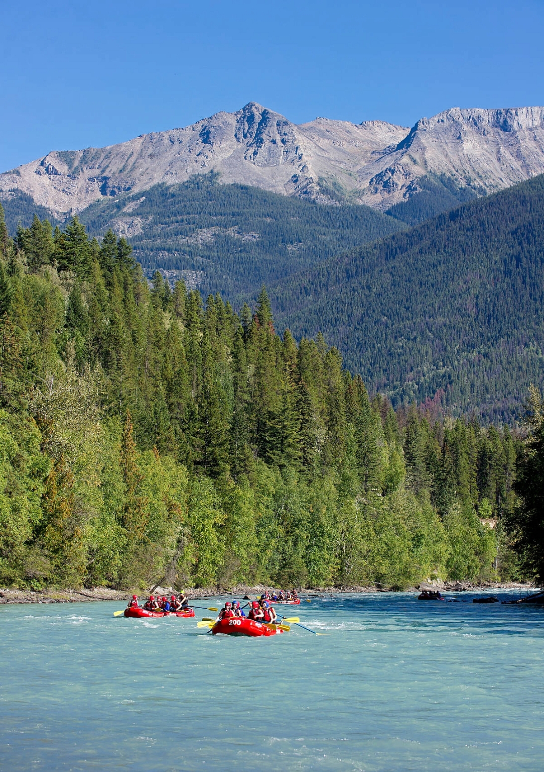
Valemount is located just 20 minutes from Mount Robson in the southeastern corner of The Great Wilderness on Simpcw Nation lands. The highest peak in the Canadian Rockies, this imposing granite giant has long-defined life in the valley. To the Texqakalit First Nation—the first inhabitants in the area—it is known as Yuh-hai-has-kun, or “mountain of the spiral road,” a nod to its layered appearance.

Early adventurers—and present-day hikers and mountaineers—have long been drawn to challenge themselves on its formidable peak. For locals, its temperamental weather means the difference between a sunny day outside or one that’s waterlogged. But like all good mountain towns, Valemount residents know there is no bad weather, only bad gear. Take a cue from them and suit up for all manner of outdoor adventures. The area is home to an extensive multi-use trail network criss-crossing three of the most famous ranges in the province: the Rockies, Monashees, and Cariboos. While Mt. Robson’s Berg Lake Trail is Valemount’s most iconic hiking route, countless others lead to sweeping vistas, hidden waterfalls, and glacier-carved outcrops—often without a single other hiker in sight. Mountain bikers, ATV’ers, and heli-skiers will also find remote and solitary routes tucked deep within these ranges.

Visiting communities in The Great Wilderness offers both heart-pumping adventures in otherwordly landscapes, and the unique opportunity to connect with First Nations cultures, warm-hearted locals, and a deeper story of stewardship and respect that spans time.

Plan Your Trip

GETTING HERE

The scale of The Great Wilderness can sometimes be hard to grasp. There are several gateways into these awe-inspiring landsStarting on the West Coast of British Columbia, Prince Rupert is a Pacific Ocean port city accessible by both highway and BC Ferries. From here, you can travel north towards the Yukon and Alaska borders, or east towards the town of Terrace and northwestern BC. Further inland, the outdoor-oriented city of Prince George is a prime base camp to the north, connecting to both Stewart-Cassiar Highway and Route 16. Those travelling into the Northern Rockies or to Tumbler Ridge can begin their trip at Dawson Creek (Mile 0 of the Alaska Highway), or further north in Fort St. John with frequent flights into the North Peace Regional Airport.

Plan Your Adventure Now

Need to Know

Find key travel information to plan your BC vacation.

Travel Info
Adventure Smart

Always check trail conditions before you head out, and no matter what outdoor activity you are planning, be prepared.

Plan Your Route
Plan Your Route

Check Drive BC for the latest information on road closures around the province.

Check Conditions
Travel Responsibly

Follow these tips to travel safely and responsibly in BC this season.

See the Tips
Places to Stay

Discover everything from luxury hotels and B&Bs to wilderness lodges and campsites.

Find Accommodation
Loading, please wait...
AI Chatbot is in-training and can make mistakes. Consider checking important information.
Terms and Conditions