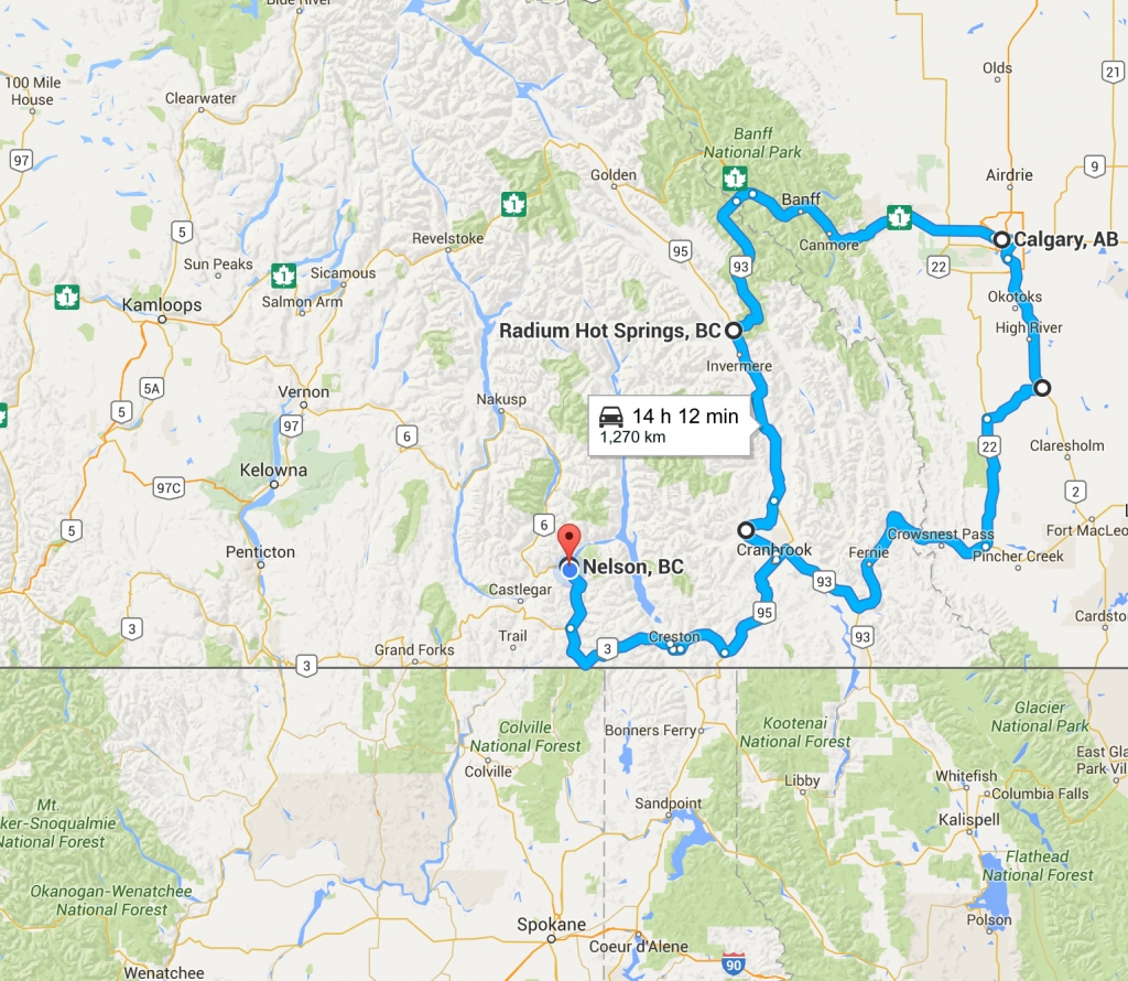
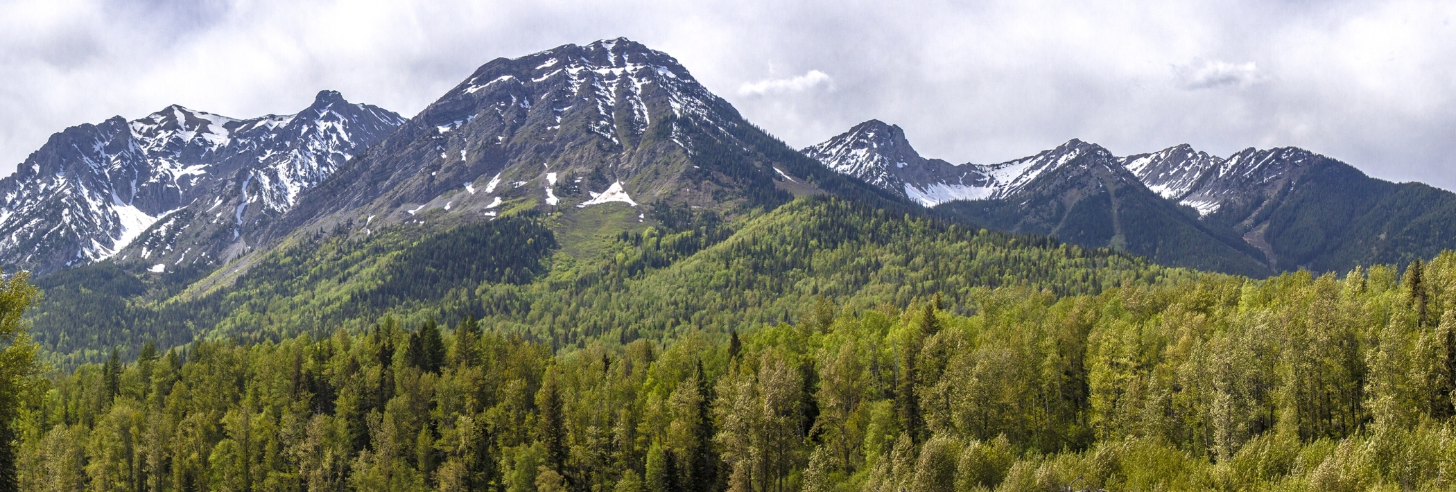
There’s a lot of British Columbian beauty between Calgary and my home in Nelson.
I recently took a road trip that passed through Kimberley and Kootenay National Park on the way to Calgary, then through Fernie and along the Crowsnest Highway on the way back.

Our circle route from Nelson to Calgary and back. Click to open in Google Maps.
The area is mountainous, and—for me, at least—mountains mean photo ops. When he saw my camera packed alongside my bag, my boyfriend knew there would be side trips. What follows are the visual highlights.

Looking up at the towering Dutch Creek Hoodoos.
Situated between Kimberley and Invermere, Dutch Creek doesn’t look like much at first—a low bridge across a rapid creek— but travel a minute more, and suddenly the highway is lined with strange rock formations standing guard. These are the Dutch Creek hoodoos.
To get close, look for a small dirt road to the left just after the bridge. The road is gated, so you’ll have to hike in. Travel parallel to Dutch Creek, and eventually the route diverts and puts you in full view of the hoodoos.

The highway crossing Dutch Creek, as seen from the dirt road leading to the hoodoos.
Columbia River near Invermere

The serene Columbia River Valley.
The first time I saw the Columbia River snaking through a valley, I had no idea that this mighty river flows to the Pacific Ocean, or that I was looking at the river of Lewis and Clark fame. I knew only that it was beautiful.
That initial view stopped me in my tracks, and partially inspired my move from the United States to BC. In this view near Invermere and Radium Hot Springs, the sun was hitting just the right spots: the bluffs, the spring green of the valley floor, and the surface of the water.

Vantage point overlooking the grandeur of Kootenay National Park.
Kootenay National Park is like a “bite-sized” version of BC. The upward climb of mountains from the floor to the sky, the icy blue water forever rushing, the wildlife that makes humans feel like visitors: it’s all an example of how life throughout British Columbia actually plays out.

Tall trees and mountain peaks as seen from Elk Valley Provincial Park.
I watched the Elk River play hide-and-seek with thick trees alongside the Crowsnest Highway as we descended from the Rockies into Sparwood in the east Kootenays. I wanted to put my feet in, and the chance came when we spotted Elk Valley Provincial Park right off the road.
A footpath, nearly invisible from the masses of long grass and dandelions, led us through the floodplain to the banks of the river. There would be no wading here: the current in this area was fast, and the water deep.
I stepped carefully onto the spongy ground, sat on the driest spot I could find, and watched the water part around my feet. I thought back to hotter days spent kayaking along this stretch of river, with the Kootenay Rockies dominant in my view.

Signs of beaver along the Elk River.
Fernie

Fallow fields in Fernie.
Fernie is one of the most picturesque settings for a town that you can imagine. I have yet to see a photo that actually does it justice, largely because a picture can’t convey the quiet, the freshness of the air, or the feeling of being overwhelmed by mountains.
Fernie is where I nearly put my bags down as it was the first place in BC where I had a literal slack-jaw experience. I’ve been in mountain towns, plenty of ski resorts, and I’ve seen a lot of wild mountains, but to have it all co-exist in one place, and in such a pristine way was astonishing. Every time I pass through, that feeling returns.
Wardner

Kootenay River with the Steeples Mountains in the background.
The unexpected is something I should be used to by now in BC, yet this sight caught me off guard. We’d been driving through mostly tight channels with mountains on either side, and then the view opened wide. The new grass on the Kootenay River floodplain was covered in gold, both from the sun and the dandelions, and the Steeples Mountains looked ready to scrape the clouds.
I must have passed through Wardner before, but the views across this province have a way of looking new every time.

Rugged, snow-capped peaks make a beautiful backdrop for this barn in Warder.
One of my life-long fascinations is old buildings. As a kid, my mom—who also loves a good road trip—would stop every time she saw an abandoned structure out in the country to take a closer look at its details. For me, this extends to old barns, both long-forgotten and those that are still in use. I love the fading colour, their relative size in the often-grassy landscape, and the thoughts they conjure up of hard working people in a hand-built age.
Creston

Grain elevators overlooking the Creston Valley.
If Fernie is one of my favourite mountain-view towns, Creston, on the opposite side of Kootenay Pass from my home, is one of my favourite valley-view towns. The valley takes on the feel of a vast meadow; it is a shade of green that feels lush and wet like springtime. The sky and mountains that surround Creston look different throughout the day and across the seasons, but there is always that fertile green. At least until snow blankets it all.

This black bear was busy filling up on a vegetarian feast and didn’t seem overly concerned about our presence.
Kootenay Pass marks the homestretch for Nelsonites returning from an eastern journey. It is home to the tiny Stagleap Provincial Park, which provides easy access to outstanding backcountry skiing, and habitat for plenty of wildlife.


